Snow and ice professionals will look back on the 2016-17 winter with varied feedback. Some will rank the season among the best across the Pacific Northwest and northern Rockies as cumulative snowfall totals were often two to three times higher than normal. Many snow lovers south of the Great Lakes and Mid-Atlantic states likely have been convinced otherwise as the bulk of the storms have spared their region. Less than 2 inches of total snowfall has fallen to date from Baltimore to Washington, D.C., and much of the Ohio Valley is running 50 to 60 percent below normal.
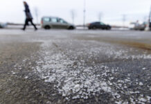
With that said, most will view the winter as being difficult to manage due to nearly half of the storms producing wide swaths of mixed precipitation and ice.
After a slow start of only two developing winter storms across the continental United States in the latter half of November, the winter season featured a big reversal from mid-December through February with an additional 15 named winter storms by the Weather Channel. Of the 15 storms, two major storms have affected the East Coast with the remainder of them mostly affecting the West, upper Midwest and northern New England with snow and often some variety of ice.
The experienced ENSO neutral to weak La Niña was not the driving force of the weather patterns experienced so far this winter. The main players of the 2016-17 winter can be largely attributed to the unusual persistent trough in the West and the subtropic ridge along the East. This frequent pattern led to the formation of harsh winter storms and higher than normal snowfall across the Pacific Northwest.
These storms often took a similar track into the northern Rockies/upper Midwest and eventually into eastern Canada or the northern New England states where many locations also recorded above-normal snowfall. Unlike most winter seasons, a prolonged cold was hard pressed to find across the northeast and Mid-Atlantic states as cold outbreaks only lasted a few days at a time.
December: Active start in the west
The first half of December was marked by the development of four named storms. The first two (Carly and Decima) followed a similar path during the first half of December from the Pacific Northwest before heading into the Rockies and Midwest. Carly resulted in hundreds to thousands of cancelled flights from Chicago to Detroit and eventually brought the Northeast their first accumulating snow on Dec. 12 before moving out to sea. Winter storm Decima (Dec. 13-18) was well known for the widespread freezing rain, wind and sub-freezing temperatures to the plains states, which resulted in hundreds of accidents and eventually the major tanker explosion pile-up on I-95 in Maryland. Winter storm Europa resulted in more than a foot of snow and blizzard conditions to the Dakotas on Christmas weekend. Finally, a rapidly intensifying storm off Cape Cod (Fortis) closed out the month with heavy snow, gusty winds and power outages to New England from Dec. 28-30.
January: Snow, ice and flooding rains
The common trend of the six January winter storms during the month was the West Coast development and various combinations of heavy snow, sleet and freezing rain each one produced. Winter storm Helena started off the month from Jan. 3-7 and brought over a foot of snow to the Pacific Northwest. It became notorious for the sleet and freezing rain that wreaked havoc on roads and kept schools closed for days from Alabama to Virginia. This storm also produced the first decent accumulation along I-95 from New York City to Boston. Winter storm Jupiter (Jan. 11-19) was the first West to East Coast storm and left behind a record-setting foot of snow in Portland (the first time in 22 years), 3 to 7 feet of measurable snow in four western states and the Sierra Nevada, an inch of ice accretion to the plains states and eventually several inches of snow and ice before losing its punch in upstate New York and northern New England. Two final storms, Kori and Leo, closed out the month of January effectively ending the long-time drought with more than a foot of flooding rains to California, widespread mountain snow and 1 to 2 inches of ice in northern Oregon and parts of Washington.

February: In the Northeast
The West finally shared some of the winter storms with the Northeast in February. The heaviest and most widespread snowstorm of the season occurred across the northeast and I-95 corridor with winter storm Niko from Feb. 8-9. Despite Niko being a rather quick-moving storm, rapid intensification off the eastern seaboard resulted in snowfall rates ranging from 1 to 4 inches per hour from northern New Jersey and New York City into the southern New England states. Boston recorded blizzard conditions for over four hours during the storm. Accumulation of a foot or more of snow was very common with this storm with some amounts up to 2 feet in southern New England. Just days after, winter storm Orson hammered Upstate New York and New England with another foot or more of snow to parts of Upstate New York, Vermont, New Hampshire and Massachusetts from Feb. 10-13. Strong, gusty winds also resulted in widespread power outages along the East Coast.

What’s in Store for the 2017 Spring?
Overall, ENSO neutral conditions are expected to continue for the spring months with neither La Niña nor El Niño affecting the global weather pattern. With that said, WeatherWorks long-range meteorologists expect the persistent trough across the Pacific Northwest to continue for April, which will result in a cool and wet start across the West. This would favor a warm, active pattern from the plains to the Midwest with a higher than normal potential for severe weather outbreaks from April to May just east of these tracking low pressure systems. Although the ridge along the East Coast could fluctuate at times, the overall pattern is favorable for warm, dry conditions in the Southeast and generally near normal temperatures and slightly drier conditions for the Northeast.
6 Unusual Winter Stats (through Feb. 2017):
- 8 of the 17 winter storms produced moderate to significant icing spanning multiple states at a time.
- Record-setting 3 to 7 feet of snow to the mountains of the Sierra Nevada region from winter storm Jupiter starting Jan. 9.
- Chicago has not seen more than 1 inch of snow since Dec. 16-18, 2016 and has recorded only 0.7 inches in 2017. It is the longest snow drought to the area since 1884.
- The Baltimore airport (BWI) is currently tied for the least snowy winter (0.7 inches) since the 1949-50 winter season.
- Only 20.4 percent of the U.S. is experiencing snow cover on the ground due to the widespread, record-breaking warmth in the second half of February.
- Lowest Great Lakes ice cover in 20 years due to the lack of long-term cold.




![[VIDEO] Dickies®: Discover Workwear That’s Anything But Uniform](https://turfmagazine.com/wp-content/uploads/2023/06/1647663814-4b1a2a7742790a9b1e97a3b963477850192e1d6a9dfba9b07214a77bae25d6e3-d-218x150.jpg)












![[VIDEO] Dickies®: Discover Workwear That’s Anything But Uniform](https://turfmagazine.com/wp-content/uploads/2023/06/1647663814-4b1a2a7742790a9b1e97a3b963477850192e1d6a9dfba9b07214a77bae25d6e3-d-324x160.jpg)